

Native forest converted in the Paraguayan Chaco, 1986–2022.
Historical INFONA series summarized in the project description, p. 731.Creative Carbon / Our workA landscape.
Gran Chaco · Paraguay
A landscape.
A living future.
Paraguay’s largest Avoided Planned Deforestation REDD+ project. Developed by Creative Carbon, with ongoing technical support from our team.
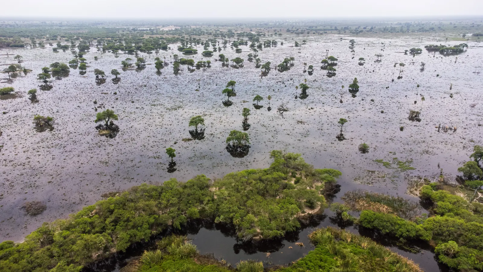 Chaco Vivo / Paraguay
187,916 ha
Conservation property
APD REDD+
Avoided Planned Deforestation
Paraguay
Gran Chaco region
For scale
How big is 187,916 hectares?
The Chaco Vivo conservation property covers about 1,879 square kilometers (726 square miles). The drawing places real city outlines over the property at the same true-area scale.
- 2.4×the land area of New York City (778 km²)
- Nearly 12×the land area of Washington, D.C. (158 km²)
- 16×the area of Asunción, Paraguay’s capital (117 km²)
2.4× New York City fits inside the property 2.4 times by land area.
A landscape under pressure
What disappears
when a forest
disappears?
Habitat. Stored carbon. Water systems. A connection between people and place.
The Paraguayan Chaco has experienced decades of conversion from native forest to agricultural land, especially cattle pasture. Chaco Vivo changes the economic proposition: maintain a living forest through carbon finance and long-term conservation.
Of native-forest land-use change in the Chaco occurred under approved land-use plans in INFONA’s 2022–2024 report.
Legally permitted conversion is central to the APD story.One connected conservation property at Chaco Vivo.
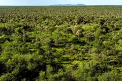
Forests, wetlands and habitat corridors within the project landscape.The forest-loss figure is a historical total, not a current annual rate. INFONA’s latest report records a downward trend in deforestation; approved conversion remains a significant conservation challenge. Sources and definitions
Understanding the distinction
Same goal.
Different deforestation threats.
REDD+ projects reduce emissions by keeping forests standing. APD and AUD describe the type of deforestation a project is designed to avoid.
| The distinction | Chaco Vivo’s approachAPDAvoided Planned Deforestation | A different REDD+ pathwayAUDAvoided Unplanned Deforestation |
|---|---|---|
| The threat | Documented, planned conversion of forest to another land use, with an identifiable conversion agent and legal authorization. | Unplanned forest loss, often driven by dispersed encroachment, shifting agricultural frontiers or multiple actors. |
| The evidence | Land-use rights, permits, conversion plans, financial evidence and the timing of the proposed clearing. | Historical deforestation, land-use drivers, regional risk and the expected location and rate of future forest loss. |
| The intervention | Change a documented land-use decision so the forest is retained instead of being converted. | Address the underlying pressures and activities that would otherwise lead to unplanned clearing. |
| Shared requirements | Both approaches require credible additionality, conservative baselines, monitoring, safeguards, leakage assessment and management of permanence risk. APD and AUD describe different threats, rather than a universal ranking of project quality. | |
The Chaco Vivo case
A permitted change of use.
A different future for the forest.
The project description documents legal authorization to convert 108,077 hectares to agricultural and livestock uses. Carbon finance supports a change from planned conversion to conservation.
187,916 haTotal conservation property
108,077 haAuthorized conversion area, used for REDD+ GHG accounting
Climate, Community & Biodiversity
Triple Gold.
Three dimensions of impact.

Chaco Vivo’s project description addresses all three Gold Level criteria under the Climate, Community & Biodiversity Standards. These criteria connect climate resilience with exceptional benefits for people and biodiversity.
Climate change
adaptation benefits
Strengthen resilience to climate pressures through ecosystem protection and activities that support Indigenous and rural communities’ ability to adapt.

Exceptional
community benefits
The L.I.F.E. Program™ links conservation with livelihoods, education, health and well-being, with a design that addresses all 17 UN Sustainable Development Goals.
Exceptional
biodiversity benefits
Maintain critical habitat and high conservation values, including Laguna Ganzo, an Important Bird Area, and habitat for threatened and vulnerable species.
Gold Level criteria are distinct from the VCS quantification of greenhouse-gas benefits. The project description sets out the basis for assessment under each criterion.
Creative Carbon’s role
From project design
to evidence
on the ground.
We developed Chaco Vivo and continue to provide technical support as the project moves forward.
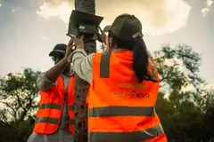
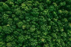
Our work covers project design, methodology, carbon accounting, technical documentation and the integration of monitoring, reporting and verification systems. Field evidence and remote sensing connect the conservation landscape with the project’s technical foundations.

 01
Project design

 02
Methodology

 03
Carbon accounting

 04
Technical documentation
 05
Monitoring, reporting and verification (MRV) systems
 06
Field evidence and remote sensing
Project proponent
Atenil S.A.
Project developer
Creative Carbon
Project developer and a co-project administrator.
Operations
Victoria Paraguay
Supports operations, logistics and stakeholder engagement.
Field evidence
Mapping, measuring,
checking.
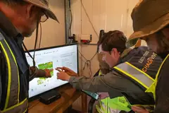
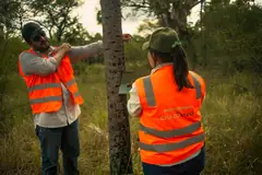
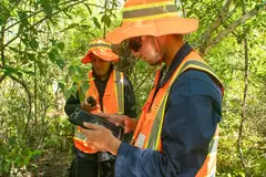
Photographs from Chaco Vivo field and review work: land-cover mapping, inventory procedures, data collection in the forest, and visits across grassland and wetland. Select a photograph to enlarge it.
Reviewing land-cover mapping
Inventory procedures, calculations and QA
A working session around the table
Reviewing field imagery
Checking the map in the forest
Recording data on a tablet
Comparing devices on the trail
Reading documents in the forest
Crossing wet grassland
On foot through the grassland
Notes on the road
Briefing beside the vehicle
Biodiversity
Meet the living landscape
In the Paraguayan Chaco, as much as 1,000 hectares of forest can be lost to cattle ranching in a single day. Chaco Vivo manages its 187,916-hectare property for biodiversity where the dry, sub-humid and humid Chaco meet, near the Paraguay River. It holds the Laguna Ganzo Important Bird Area, home to more than 250 bird species, and some of the region’s last wildlife corridors. Camera traps on the land have already recorded 26 species. Here are six we’re working to protect.

Jaguar
Panthera onca · Yaguareté
As the Chaco’s top predator, the jaguar helps keep the food web in balance, and its loss ripples outward. Jaguars need big, connected forests, and in the Chaco they are often killed in conflict over cattle. Camera traps have recorded jaguars on Chaco Vivo, where they are a key species we monitor.
- IUCN: Near Threatened (2016)
- CITES App. I
- Paraguay: En peligro de extinción (Ley 5.302/2014; SEAM Res. 632/2017)

Maned wolf
Chrysocyon brachyurus · Aguará guasu
With its long legs and rust-red coat, the maned wolf is one of South America’s most striking animals. As one of the Chaco’s larger predators, its decline would be felt across the ecosystem. Camera traps have recorded maned wolves on Chaco Vivo, and keeping their habitat whole is part of our work.
- IUCN: Near Threatened (2015)
- CITES App. II
- Paraguay: Amenazada de extinción (SEAM Res. 632/2017)

Lowland tapir
Tapirus terrestris
This shy, heavyset plant-eater browses along forest edges and waterways and needs wide areas of undisturbed habitat. Tapirs breed slowly, so hunting and forest loss hit them hard. Camera traps on Chaco Vivo have recorded tapirs 32 times, and the project estimates about 400 live across the surveyed landscape.
- IUCN: Vulnerable (2018)
- CITES App. II
- Paraguay: Amenazada de extinción (SEAM Res. 632/2017)

Chaco eagle
Buteogallus coronatus · Crowned solitary eagle
Only 800 to 2,000 adults of this large eagle are thought to remain. Pairs raise one chick at a time, nest in tall trees and range over hundreds of square kilometers. Laguna Ganzo, inside Chaco Vivo, is recognized as an important site for the species, and it has been recorded on the property.
- IUCN: Endangered (2024)
- CITES App. II
- Paraguay: Protected species (MADES Res. 254/2019)

Chacoan peccary
Catagonus wagneri · Taguá
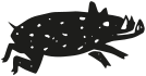
The taguá lives only in the Gran Chaco of Paraguay, Bolivia and Argentina, where it plays an important part in spreading seeds. Its numbers keep falling as forest is cleared and broken up. Camera traps have recorded the taguá on Chaco Vivo, one of the largest unbroken stretches of Chaco forest left in the region.
- IUCN: Endangered (2011)
- CITES App. I
- Paraguay: En peligro de extinción (SEAM Res. 632/2017)

Palo santo
Bulnesia sarmientoi · Yvyra okái
Palo santo grows in the Chaco’s semi-deciduous forests, and its heavy wood and extracts are traded internationally. Logging and land clearing have made it Endangered, and a single generation can take 35 to 70 years. The project has recorded palo santo on Chaco Vivo, where intact forest gives it a chance to recover.
- IUCN: Endangered (2017)
- CITES App. II
- Paraguay: Protected species (MADES Res. 512/2025)
Sources: IUCN Red List; BirdLife International; CITES Species+; Paraguay Ley 5.302/2014, SEAM Res. 632/2017, MADES Res. 254/2019 and 512/2025; Chaco Vivo Project Description (Verra ID 3671).
One landscape. Connected priorities.
Climate
Conserving forest carbon stocks by addressing planned deforestation and supporting long-term forest protection.
Biodiversity
Protecting native habitats and the extraordinary biodiversity of Paraguay’s Gran Chaco.
Communities
Chaco Vivo’s L.I.F.E. Program™ connects conservation with education, health and livelihood opportunities in nearby communities.
Meet the communitiesCommunities
People at the heart
of the landscape.
Fourteen Indigenous communities and the river town of Puerto Casado sit within Chaco Vivo’s area of influence. Their consent, priorities and work shape how the project runs.
No communities live inside the project area, and no relocation has been required. The property does not overlap Indigenous reserves or areas communities use, and there is no land dispute with any Indigenous community. Engagement reaches across a wider area of influence, at least 20 km beyond the project boundary, extended east to include Puerto Casado.
Indigenous communities in the area of influence, from five peoples of the Lengua Maskoy language family.
Over 5,000 people live in those communities.
Communities have completed the formal consent process. It is ongoing with the other seven.
In Puerto Casado are receiving legal title to land they have lived on for decades, through a program reaching more than 1,000 people.
West of the property
Presidente Hayes
Toba Maskoy and Sanapaná villages in the Teniente Irala Fernández area, with a Northern Enlhet community further south.
East of the property
Toward the Paraguay River
Seven Angaité, Toba Maskoy and Guaná communities near Puerto Casado and Puerto Pinasco. Guaraní is the main language, families make karaguatá and palm-leaf crafts, and safe drinking water is the most pressing need.
The project’s local base
Puerto Casado
The closest town, on the Paraguay River about 53 km east of the project area. The project keeps a permanent office here, as well as in Asunción.
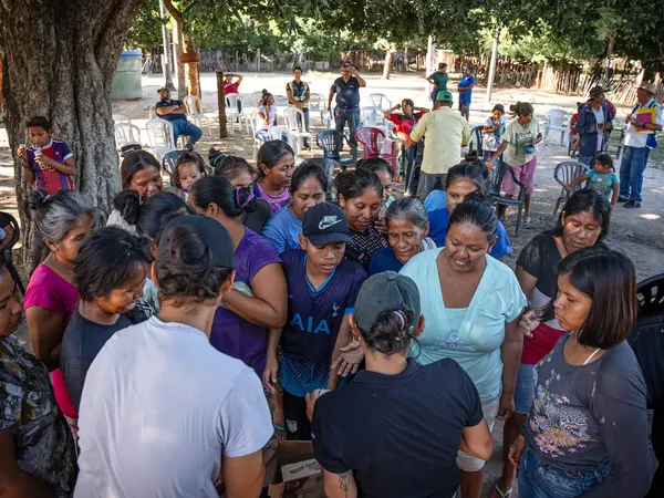
A community gathering
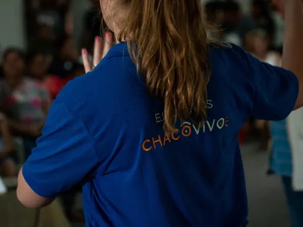
A Chaco Vivo team member speaks with participants
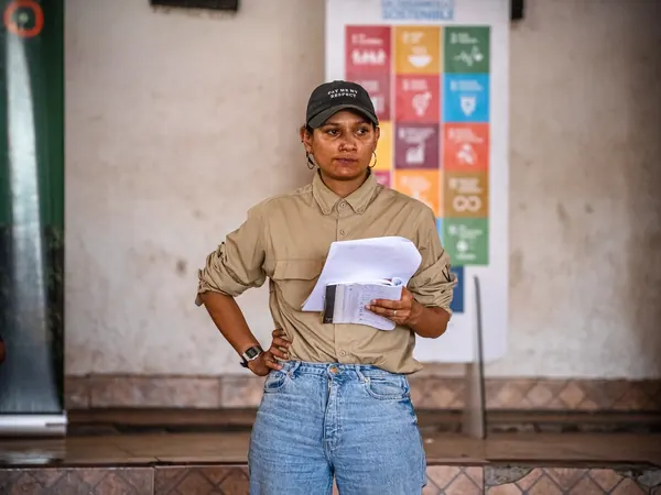
Presenting, with the UN Sustainable Development Goals behind
Consent comes first
Indigenous communities are consulted under Paraguay’s free, prior and informed consent protocol, Decree 1039/2018, in line with ILO Convention 169. Formal consultations are facilitated by the NGO SER (Sociedad de Estudios Rurales y Cultura Popular), which has more than 40 years of experience in rural and Indigenous communities, with oversight from INDI, the national Indigenous affairs institute. Communities can withhold or withdraw consent at any time, without retaliation.
Listening in local languages
Consultations are held in Spanish, Guaraní and Indigenous languages. Field staff speak Spanish and Guaraní, community members work as liaisons, and the team visits every week. Community assemblies, household surveys and focus groups with women and young people have informed the project’s design; women made up 68% of participants in the diagnostic workshops. A community board with local representatives oversees the social programs.
Benefits, shared openly
Communities helped design the benefit-sharing mechanism and set its priorities: social infrastructure, education scholarships, health services and new sources of income. Carbon credit revenue funds the L.I.F.E. Program™ and other social programs. Annual assemblies and advisory committees give communities a say, and project costs, benefit allocations and budgets are presented to them.
Work close to home
The forest ranger program hires from communities in the area of influence, with priority for nearby Indigenous communities, and is expected to employ up to 300 people directly and in support roles. Hiring follows equal-opportunity principles and equal pay for equal work, with outreach to women, young people and vulnerable groups. Training includes carpentry and ecotourism.
Programs on the ground
The project has delivered more than 3,200 emergency food kits to communities since January 2022, including after the March 2023 floods, and has helped an Indigenous community build water storage. Planned and ongoing work includes rainwater capture, cisterns and wells, climate-smart farming training, health programs, honey and other forest products, and the donation of about 35 hectares of urban land in Puerto Casado for community use.
A clear way to raise concerns
Anyone can raise a grievance at community meetings, at the project offices, by WhatsApp, through the website or by email at redress@chacovivo.com. Complaints can be anonymous, and a complainant’s identity stays confidential unless they ask otherwise. Most are meant to be resolved within 30 days, with independent mediation available. Paraguay’s environment ministry, MADES, also receives complaints about forest carbon projects.
Figures come from the Chaco Vivo project description. Population figures are estimates and employment figures are projections. Sources and definitions
From the project
A closer look.
Wildlife from the project collection.
A closer connection to the living landscape.

Project sources & definitions
Project description: CCB & VCS PD 3671, version 7.0, 2 August 2026. Gold Level criteria: p. 2; project scope and biodiversity: p. 5; developer roles: p. 15; area definitions: pp. 32, 37–38; historical forest conversion: p. 731; communities, consent, benefit sharing, employment and grievances: pp. 80–92, 151–155, 179, 185–189, 215–220, 553–557, 578–588.
Project scale: “Paraguay’s largest” describes Chaco Vivo among REDD+ projects in Paraguay. The 187,916 ha conservation property and the 108,077 ha GHG accounting area are different spatial measures.
Forest-change context: INFONA’s official summary of the 2022–2024 national forest report .
Standards: Verra’s CCB Standards and Gold Level criteria ; planned deforestation module ; unplanned deforestation methodology .
Keep exploring
More from Chaco Vivo.
For further project information and updates, visit the official Chaco Vivo website.
 Talk to us